NASA
Jet Propulsion Laboratory
California Institute of Technology
Skip Navigation
Follow JPL
menu
close modal
Resources
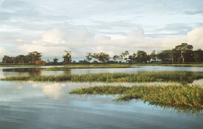
Lake Calado, Amazon
Published:
May 10, 2014
Lake Calado, Amazon
ENLARGE
Related
An artist’s concept of the SWOT spacecraft (January 2012).
SWOT Spacecraft (Artist Concept)
A photograph of the Varzea Forest area of Brazil (2 of 4).
Varzea Forest, Brazil
This collaborative mission poster, designed by CNES (French Space Agency), shows the Surface Water and Ocean Topography (SWOT) satellite soaring over an abstract of a water molecule.
Surface Water and Ocean Topography (SWOT) Mission Poster
A Flooded Forest in the Amazon
A Flooded Forest in the Amazon
An artist’s concept of the SWOT spacecraft (March 2012).
SWOT Spacecraft (Artist Concept)
SWOT technologies - advanced wide-swath technology, ocean and surface water topography measurements, and high-resolution products - will support such societal needs as dams, shipping, and surface w...
SWOT Technologies and Societal Needs
Highly visible in their red shirts, SWOT project team members - including Project Manager Parag Vaze at left - interact with the public during the NASA Jet Propulsion Laboratory (JPL) "Open House" ...
SWOT Exhibit at JPL Open House
SWOT will collect data across a 75-mile (120-kilometer) wide swath, with a gap in the center for an altimetry track. This animation shows the collection of data over the state of Florida, which is ...
This animation shows a simulation of SWOT collecting data over the state of Florida.
Disappearing lakes in Barrow, Alaska.
Disappearing Lakes in Barrow, Alaska
Visiting Scout uses a color-coded, calibrated stick to determine "sea surface topography" within a wooden box while his sister records his results by placing stickers on a card.
Probing the Depths of "SWOT in a Box"
Siberian Lakes
Siberian Lakes
SWOT will provide NASA’s first global survey of Earth’s surface water.
SWOT (Animated Gif)
Pictured are team members who helped load the hardware for the Surface Water and Ocean Topography (SWOT) satellite's research instruments onto a C-17 airplane pose for a picture. The payload left M...
Team members who helped load the hardware onto a C-17 aircraft for SWOT's transfer from Southern, Calif. to Cannes France.
SWOT leaving NASA’s Jet Propulsion Laboratory in Southern California, en route to March Air Reserve Base in Riverside County, California. Once the scientific payload arrived, it was sent to a Thale...
SWOT leaving NASA's Jet Propulsion Laboratory in Southern California en route to March Air Reserve Base.
Floodplain Channel in the Amazon
Floodplain Channel in the Amazon
An alternate logo for the Surface Water Ocean Topography (SWOT) Mission.
SWOT Mission Logo with Full Text
An artist’s concept of the SWOT spacecraft (February 2015).
SWOT Spacecraft (Artist Concept)
AirSWOT plays a key role in SWOT mission development. It allows scientists to study interferometric data before launch and thus be prepared to effectively interpret SWOT data after launch.
AirSWOT Platform
Jet Propulsion Laboratory (JPL) Open House visitors are delighted to see how well their color-coded stickers match the "sea surface topography" model of the Gulf Stream within a wooden box.
"SWOT in a Box" Reveal - Gulf Stream Model
SWOT is being jointly developed by NASA and Centre National D’Études Spatiales (CNES).
Centre National D'Études Spatiales
Artist’s concept of seven altimeters orbiting Earth: Jason-CS/Sentinel-6B, SWOT, Sentinel-6A, Jason 3, TOPEX/Poseidon, Jason 1 and OSTM/Jason 2.
Altimeter Series
The U.K. Space Agency will provide a part of the radar payload for SWOT.
United Kingdom Space Agency
A photograph of the Varzea Forest area of Brazil (4 of 4).
Varzea Forest, Brazil
The Canadian Space Agency will contribute to the SWOT Mission by providing a high-power assembly component for SWOT’s Ka-band Radar Interferometer (KaRIn).
Canadian Space Agency
Emblem for the SWOT mission.
SWOT Emblem